Saturday, October 17, 2009

Minnesota Highpoint


I talked my pal Dave into  joining me for a northwestern dash.  The plan was to fly up to St. Paul, rent a car, and knock out the Minnesota hightpoint.  We would then drive over to Thunder Bay, Canada, and chill out with some dinner and a few brewskis and spend the night there.


The next day we would dash down to Michigan, and catch that Highpoint, which is a quick walk, drive down to the Wisconsin Highpoint, Timms Hill, catch that one, and head back to the Hotel in St. Paul, next door to the Mall of America.   As usual, Dave would be the designated driver.


Minnesota was beautiful, the leaves were turning. It reminds me quite a bit of Maine, very 
uncrowded, and the people very friendly. The photo above shows the shoreline of Lake 
Superior, going towards Canada. 10% of the world fresh water is contained in this lake, 
and it's the worlds largest lake, by surface area. It contains islands, that have their own lakes, 
which also contain islands.
Another lake view below:


Here you can see that a fresh, light powdering of snow had fallen. The footbridge was
quite slippery, but we managed to get across without any major "slippage".

About a third of the trail is soft and easy walking, with the balance being strewn with
small to medium sized rocks. Below is a sample of the easy going part-


Less than half way to the summit you'll come to this scenic lake.  It's crystal clear, but it was a little too chilly for a dip this time!


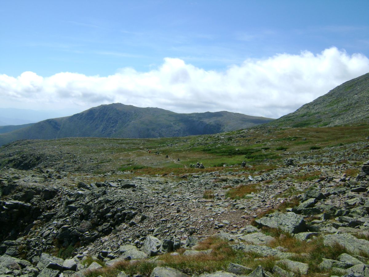
There is a nice view of the area forests and lakes from the summit, as the treeline thins out.
Don't expect to get above the treeline! There is a nice monument at the peak, and lots
of chipmunks looking for handouts.


See you at the next summit!


Sunday, August 16, 2009

Mt. Washington H.P.

The final hiking day of our 4 summit New England trip.  Note: we are still stiff from Marcy, and can barely extricate ourselves from the car to go into a restaraunt for a meal!  We decide to drive up part way, and find a nice little 4 mile hike from a side parking area. 

This required a half mile descent, in loose rock, but turned out to be very much worthwhile. 


Dave leading the descent. There was about half a mile of these large
loose rocks.  Tough work for sore legs!


Someone had placed these nice rock cairns every 100 feet or so.
Note the clouds blowing up and over the ridgeline.


You can see the trail cutting across the center of the meadow.
It was like a scene out of a Lord of the Rings movie! I expected a
Hobbit to jump out at any moment.


This was about 1.5 miles of easy walking! A very nice part of
Mt. Washington, most of which is rocky, steep and harsh.


This stream appears to just drop off to infinity.


The shot above and the next few are different views of Tuckerman
Ravine. Reminds me of photos from Ireland.


Another Tuckerman view.


Here's a nice shot right down the ravine.  This is one of the more popular
summit trails.  Will have to come back and do this one again.
We encountered a group of hikers coming up here.
We played "leapfrog" with them up the final haul, which is a
steep, rocky scramble.  Quite a workout! Dave had cut up through an
even more difficult route, just before this one, that I missed.


This is Kim, a motorcycling\adventuring pal, also from Houston.
She was up visiting friends in Vermont, and joined us for some hiking.


And finally, another peak bagged.  We just walked down the road
to the rental car, after a break and a snack in the gift store.
Glad we didn't just drive up!

Saturday, August 15, 2009

Mt. Mansfield, VT Highpoint

One day after topping Mt. Marcy, the NY highpoint, we pressed forward to Mt. Mansfield.  The drive there was perfect.  We ferried across Lake Champlain at Burlington, enjoyed a great dinner of local fish on the shore, got a well earned nights rest and set out from there to Mt. Mansfield.

Everything was sunny and bright until right at the highpoint.  Even the parking lot was sunny, yet, only 2 miles away, a dark cloud loomed over the highpoint.  It was a little chilly, even in August, and the wind was whipping around in gusts.  There were a few families on the trail, but the conditions weren't the best.
Had we not been wanting to make this a 4 highpoint trip, I would have come back on another day!


From the parking lot - not the summit, but a nice view from the outhouse.


Clouds moving in, note mountains in background.


There was about a mile of rock scrambling, it was wet, and the wind was
gusting up to 40 mph.  Would have been easy on a dry day.


This nice vista was off to the left, about half way along the trail.


Now you can see the peak disappearing into the cloud.
Did I mention we also had a few loud thunderclaps about now?
Thunder makes me nervous at altitude.  Probably not too
smart to continue.  What really amazed me was parents
with small children continuing in these conditions, with just
jeans and Tshirs.  We had rain gear in my pack.


As we got up into the cloud, the rain and wind increased.
It became difficult to see, and to walk.

Watch the video link below:


You can see the two white blazes on the rock.  At this point we
find ourselves straining for the next blaze.  Dave starts
to disappear, but he's only about 50 feet ahead.


I'm sure this would have looked even nicer in the sun!


And finally, a summit pic!  Note, rain gear is now on!


My pal Dave, now the summiting beast-


Friday, August 14, 2009

New England H.P.'s Mass & NY

This trip is day one of a three day - four highpoint jaunt.

Since the Mt. Greylock Mass highpoint is a driveup, and didn't involve an actual hike, I'll focus on Mt. Marcy New York in this posting.

We were able to catch a breakfast, do Mt.Greylock, drive to Mt. Marcy, and hike up a few miles, just above the lake and make camp. In fact, it seems most people camp near the lake, however, I suggest you push forward, and just after the next major creek crossing there is a nice site on a hillside to your right where you can hear the stream all night! Lots of trees to set your hammock in as well.


This is a view from the dam towards the mountain.  Just over three miles from trailhead.

The beginning of the trail is fairly smooth and easygoing for the most part.  A few footbridges save you from slogging thorough the mud and muck.  Hats of to the trail maintenance folks here!


On your way down you'll be happy to return to the couple of miles of soft dirt-padded trails.  This stuff is like carpet compared to the rocky obstacles you'll encounter on the topside.  

There's just enough rock hopping on the ascent to keep it interesting.  I will mention we weren't plagued by all the flies and bugs I've seen referenced in other trip reports.  Considering it was mid-August, it was also pleasantly cool as well!


Lots of nice views and vista's the higher you get.  Everything was very lush and green.  


This is my pal Dave on the left.  As I mentioned, we camped about a mile up the trail in hammocks.  It was a perfect nights sleep.  There is a deep pool to soak in nearby, with icy cold clear water.  Of course you could do this 14 mile round trip in one day, but a day and a half made it much more enjoyable, with time to poke around and check out the scenery.

This is the view from the summit.  There were a few folks at the top, lots of families and small groups. 

And finally, a shot of the summit marker.  All in all, I think this hike is very under rated in the Highpointing guides and trip reports.  The surrounding area is pleasant for driving. In fact, we took a ferry across to Burlington Vt. the next day which was an adventure in itself.  Only a couple of hours drive to Mt. Mansfield and another highpoint!

Wednesday, July 08, 2009

Chattooga River 2009

The Chatooga river forms the border between South Carolina and Georgia.
It's a beautiful, natural, protected river.  You won't see any houses or
development on this part of the river.


Above, we're disappearing momentarily in a hole. Our guide, Katie, did a fine job getting us through here.


 You can dive down into the hole in this rock, and swim through a
short underwater cave.  There is a small room underneath the spillway
where you can stand and catch your breath.  From there you can
dive out into the current, and get swept over to the bank.  Leaving your
life vest on is a requirement!


This waterfall flows into the river  from the left as you travel downstream, and it's a great photo-op and lunch break spot.


Here's a view of Katie doing her thing through another tight spot.  This one was story book perfect!


Hmmm, this is not looking good!


Here we are making a "wet exit".  Only Kris and Katie (the guide, not the fiance) were able to stay in the boat!


Time to fish out the survivors!


At a couple of stops along the route, the opportunity to leap into the rapids was given - here Kris,


Followed by Megan...


Justin.......


and Katie!


This was a great trip, a good way to spend a couple of days in the summer!