So, there are now a total of two trip reports on my blog with no photos! Did I forget my camera? Or perhaps it just malfunctioned? Lost in the woods?
None of the above. My hard drive crashed, and I had no backup of that file! When backing up my "Mountain Photos" folder, I spaced out when moving over "Black Mesa", and skipped "Black Mountain". I did it the same day I hiked Mt.Rodgers, Va.
What a contrast! Let me just say right now, that the Kentucky Highpoint was butt-ugly. There, I said it. Now, don't get me wrong, I love Kentucky, it's a beautiful state. I've hiked and had family gatherings up in the Cumberland Mountains. I even rented a houseboat up there for a week with my sister for vacation a few years back.
The highpoint, however, is the ugliest out of the 27 I've seen to date.
Now, if that changes, well, I'll be sure to post it here. I truly hope that doesn't happen. Because, friends and fellow highpointers, this was one ugly place.
The worst part, was the litter that was EVERYWHERE you looked. Mostly beer cans, fast food bags, soft drink cans, thrown everywhere. I can see it now. Four or five pickup trucks, a few coolers of beer. Listening to the Wildcats basketball game on Saturday nite. Chugging PBR, and yelling for the home team. (I know, Lexington is far away, but isn't the whole state filled with beer chugging fans?)
Add to that the mud puddle filled dirt road access, and all the radio and TV towers, and that spells, well, ugly.
Sorry if I offended anyone from Kentucky. Nothing personal, really. But crap, guys, if my state highpoint was such an eyesore, I'd get out there and clean it up myself.
So, no, I won't be going back to get photos of that one.
Which points would I do again? That's easy: (1) Harney Peak, S.D. it's beautiful, rugged, and yet it's not all that difficult. (2) Mt. Rodgers, Va. again, because it's not a difficult hike, and it's almost "enchanted". (3) For pure, raw beauty, Mt. Whitney, Ca. I'd love to go poke around there for a few days, with no pressure to summit, and take a ton of photos, relax and just chill out.
Happy climbing.
Saturday, September 10, 2005
Mt. Rogers, Va
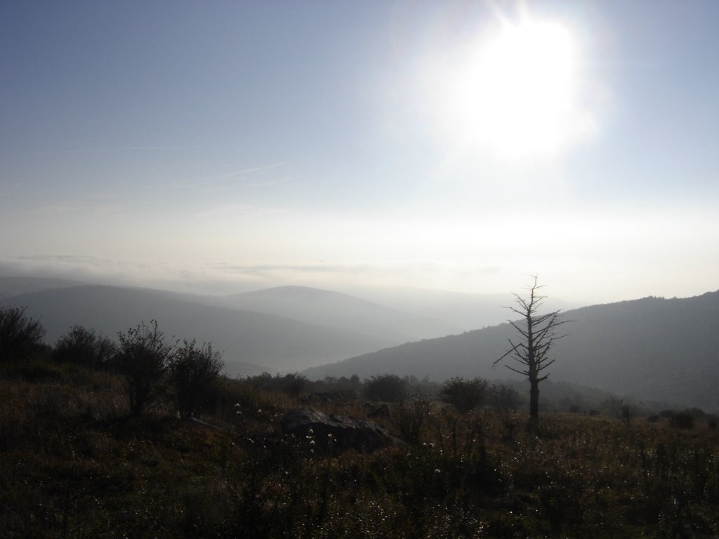
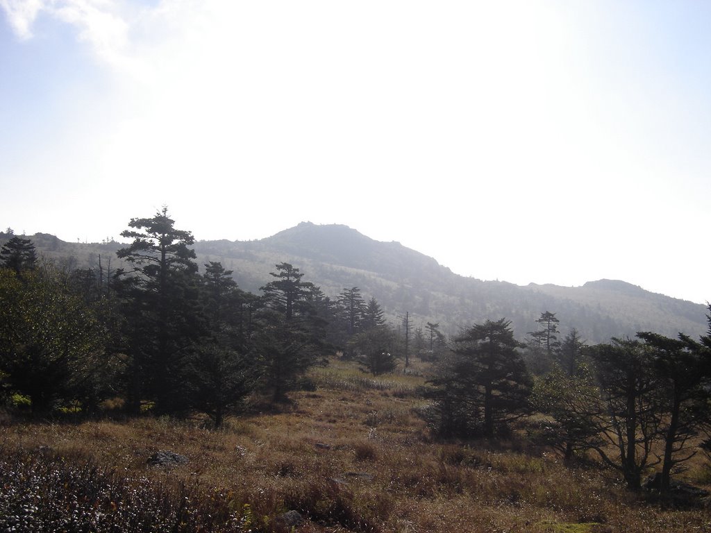
Mt. Rogers, although not a very high peak, at 4,720 feet, is a very enjoyable day trip. It was surprisingly scenic, a trip I strongly recommend. It's close to several other peaks, Mt. Mitchell, N.C., and Black Mtn. Kentucky, and Clingmans Dome, Tn. You could easliy do all four in a three day weekend.

When you come to this sign, take a hard left. It's easy to assume you're just supposed to follow the jeep road you're on which veers left, and miss the narrow path that goes 90 degrees left. Doing so will still put you back on the trail, but it's somewhat confusing. This isn't the best marked trail I've ever been on, and I noticed several others also going the wrong way on my return trip.
The trail is almost level, and only climbs 1000 feet in four miles to the summit. As you cross this field, you'll see several dozen wild ponies scattered around in small groups of 2-3.

You'll get close enough to take as many photos of these guys as you want, as they don't really run away from people. Obviously they're used to hikers. Most of them look pretty fat, and you have to wonder if they've ever really run away from anything.

This footbridge crosses over the fence, and there's a campsite just past it. This is less than half a mile into the hike. On the other side of the fence a jeep road goes to the right. The trail goes straight. Of course, I missed this, and again, went the wrong way. Fortunately, the jeep trail ended up on the Appalachian Trail, so you can get back on track. My second wrong turn of three today.
The sky was beautiful today. Fields, waving grasses, a few scattered rocks, and rolling hills.
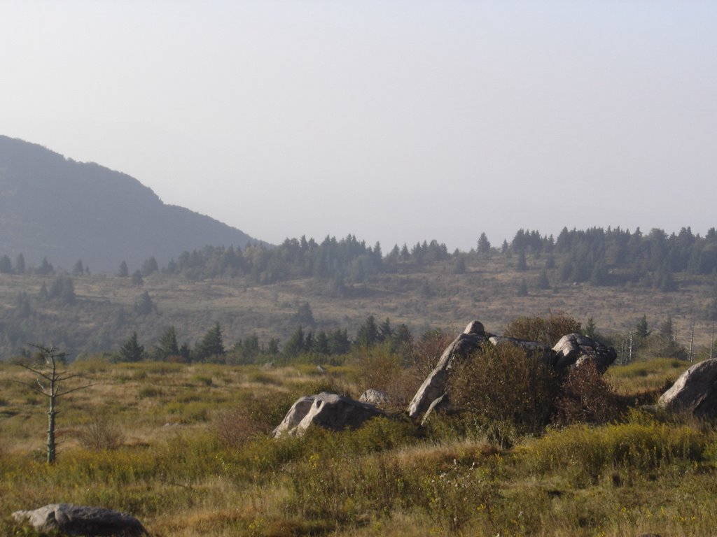
 There were a couple of side trails, this one added about half a mile to the trip up, and it was well worth it. There was a lot of steep rock scrambing. It's marked by blue blazes, and it was quite fun and a good workout.

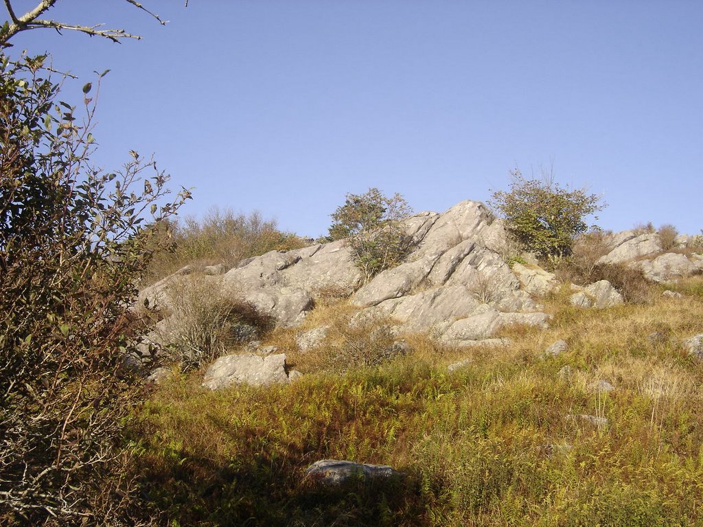
Look closely, and you can see the blue blaze in the center of this nice piece of rock. I worked up quite a sweat cutting through here! I had missed my brother in law, who was supposed to meet me for this climb. He camped out the night before. I figured by now we missed each other on the trail since I had gone off trail three times already. I did see his car in the parking lot, though....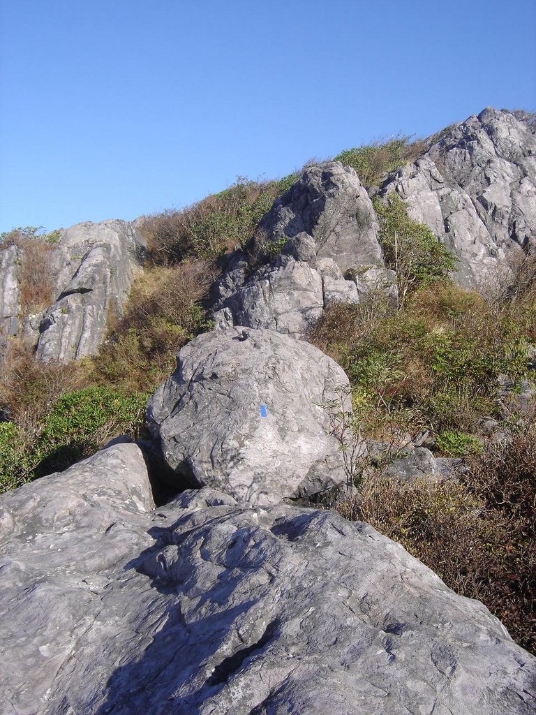
Again, the blue blaze in on the center of the large boulder there. Much easier to go over the boulder than to try to trudge through the very gnarly brush on this leg. Going down the other side of this knob was also steep and fun!

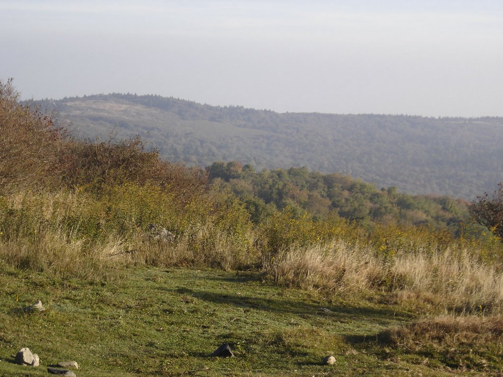
The view from the top of the knob certainly was worth the scrambling to get there! Mt. Rogers, on the other hand, is so heavy with trees there really isn't a view, so enjoy this one on the way up!
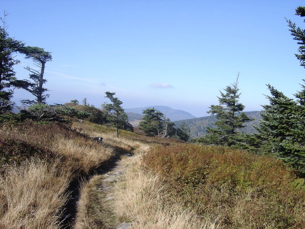
After decending the knob, you're just a short trek away from joining up to the A.T. The trail from here on up to the summit is nice and sofly padded. An easy afternoon stroll. Just stay alert here as well, as it's easy to get off track here where several trails converge. Luckily I ran into a group of camping scouts who pointed out the correct route at an unmarked intersection.
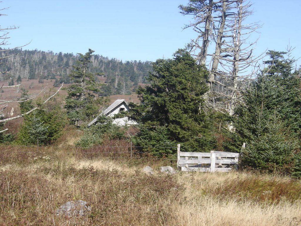
The rooftop you see in the photo below is one of the A.T. shelters. A really nice one, compared to the overrun shelters in the Smokies I remember from many years ago. And who do I find resting here? My brother-in-law, Bob! It's always nice to run into a familiar face when you're a thousand miles away from home.
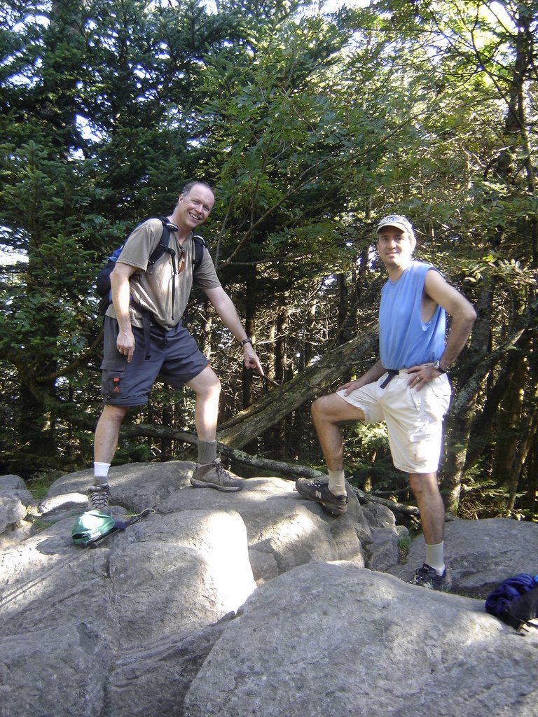
There's Dr. Bob, on the left, and his pal Dr. David on the right. Bob's pointing to the US Survey marker at the peak.
I should mention that just past the shelter, when you break off to do the final summit trail, the trees were so grown over, it got cool and "cave like" due to the thick overgrowth. It was even misty, and at least ten-fifteen degrees cooler! Other than that, the summit is uneventful.
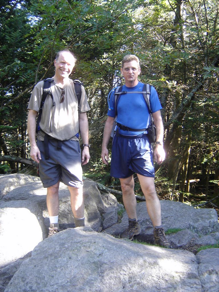
That's Bob, with me on the right, for the obligatory summit photo.
Now which relative can I con into doing the next highpoint with me?
I have to say, Virgina and it's mountains are very beautiful. I had no idea it had so much open land. The roads are nice too, I look forward to coming back someday on a motorcycle. It's trips like this that make you look forward to the next one....
Friday, September 09, 2005
Mt. Mitchell, N.C.
MARK

The Blue Ridge Parkway is not very far from where I grew up. Coming back here was a great experience. I had planned to meet my pal Tucker and we were going to ride motorcycles. When we found out he had to work, it was too late to get another travel pal - so I decided to keep my reservations, and visit Mt. Mitchell(NC), Mt. Rogers(VA), and Black Mt(KY)

As you can see, this is a popular site. There is a snack bar at the trailhead, however, if you're smart, you'll have stopped to eat at the restaurant near the park entrance. The rainbow trout was delicious, and the service was great. Keep in mind, the restaurant isn't open year round, so be sure to do this trip in the summertime!

This is a view of the trail. It is an extremely easy walk.

This is a view of the tower from below.

This one was taken from the base of the tower.

And of course, what is a highpoint trip without the obligatory pose at the top!
See you on the next mountain.
Monday, September 05, 2005
Mt. Driskill, Louisiana

If you really want adventure, go try to find Driskill Mountain without first consulting a highpoint guide for directions! This is what we did, and it took a few hours to track it down. We were all around it, asking the locals for directions, and each one gave directions with confidence. Most were wrong. It also seemed like most were a little wary to even talk to us at first. Part of the crew even gave up and headed home before we finally located the trailhead.

Finally a guy on a tractor directed us to a church, saying that the trail began past a tower behind the church. From the tower to the gate that marks the beginning of the trailhead is about 2-300 yards. You could drive a truck as far as the gate, but most cars or large touring motorcycles wouldn’t bode well on the rutted dirt road.
Note that Craig was able to negotiate the road on his BMW motorcycle.
In this photo, Tucker and Craig are in front of the gate where the trail starts. If you look closely, you can see the “TRAIL” sign to the left of the trail, just to the right of the gatepost.

. A closeup of the trail follows.

At a fork in the trial another sign points the correct route to the right.
Although rated an “easy” trial, Driskill is actually more strenuous than say, Mt. Mitchell N.C. the hightest mountain East of the Mississippi, and over 10 times higher than Driskill, which is a mere “bump” at just over 500 feet. The difference is, you drive almost all the way up on Mitchell, whereas Driskill actually gets a little steep for about a quarter of a mile. See Craig and Tucker “struggling” up the hill……


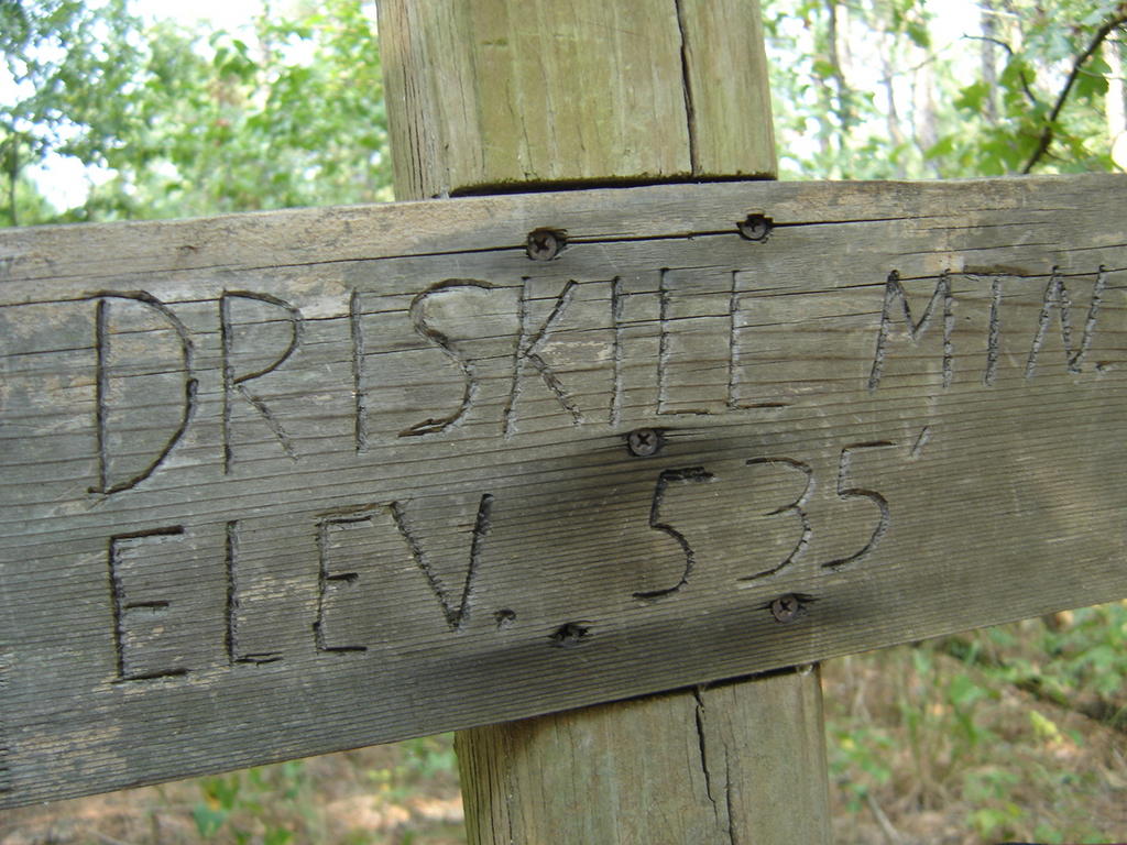
Here's a shot of Tucker and I at the peak. There is a rock pile with a sign, a logbook, and a post with the elevation marked at 535 feet.
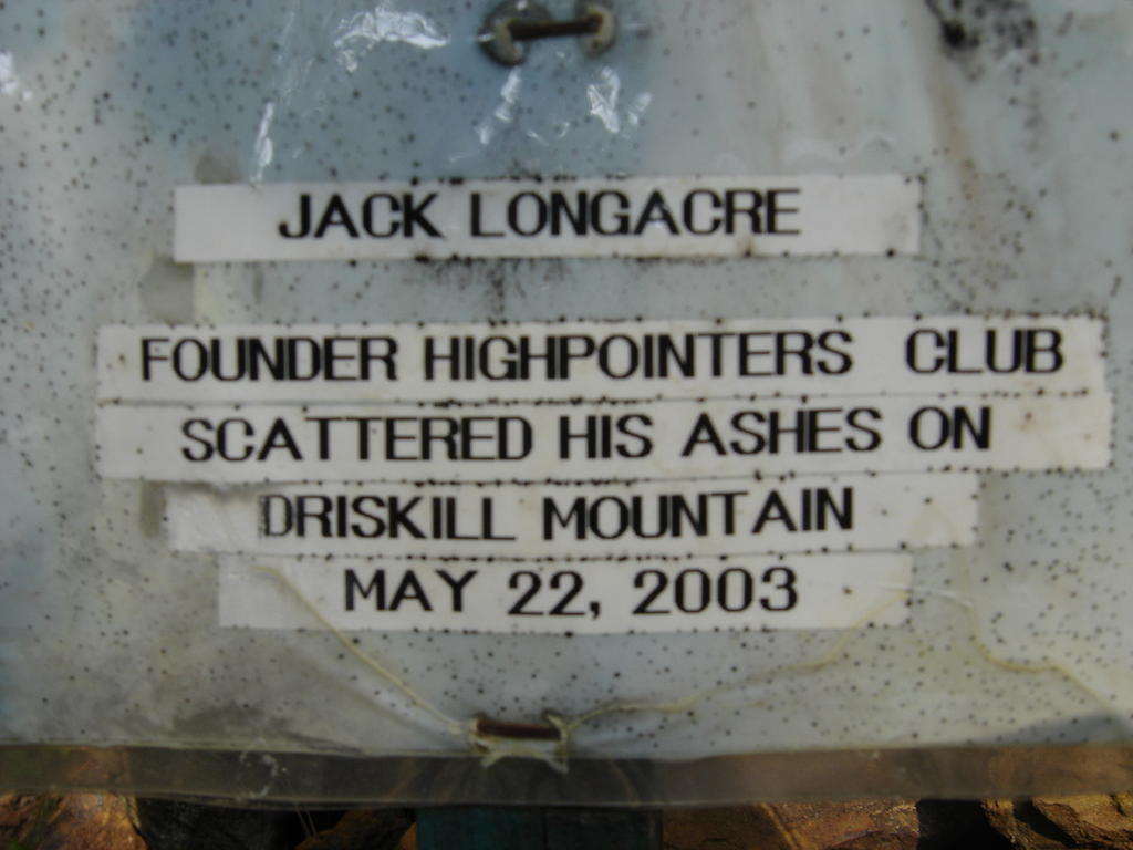
Also of interest is a handwritten monument stating: “Jack Longacre, FOUNDER, HIGHPOINTERS CLUB SCATTERED HIS ASHES ON DRISKILL MOUNTAIN, MAY 22, 2003”
It would be nice if we could put together a nice plaque for him on this peak to honor his contributions to highpointing …
Friday, September 02, 2005
Magazine Mountain, Arkansas
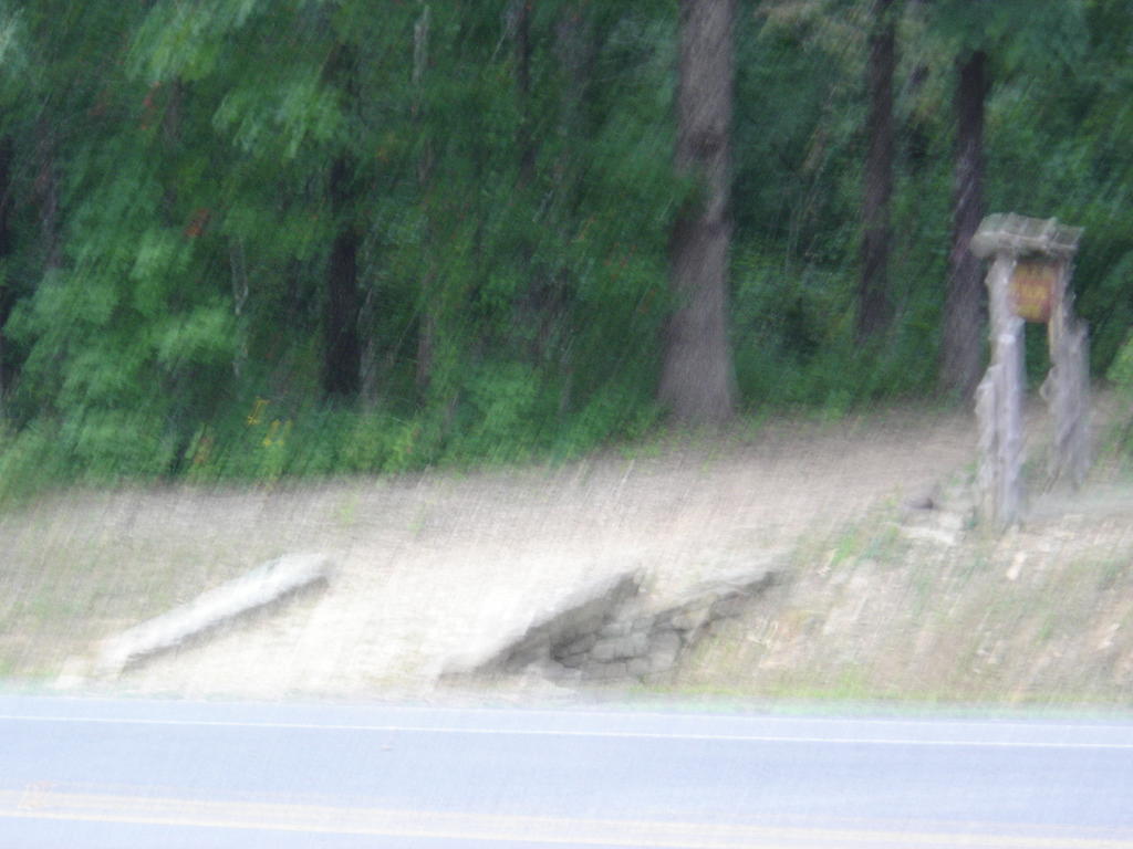
The pics of this trip came out a little fuzzy. It was a hazy day, so the shutter on the camera stayed open too long.... The hike wasn't so memorable, but it was a great labor day motorcycle ride, with my wife and my friends. We ended up covering about 1,200 miles in three and a half days.

A veiw up the short trail. This is almost a drive up, but there is a short walk to the peak from the parking lot. Craig volunteered to stay back and watch over the bikes.
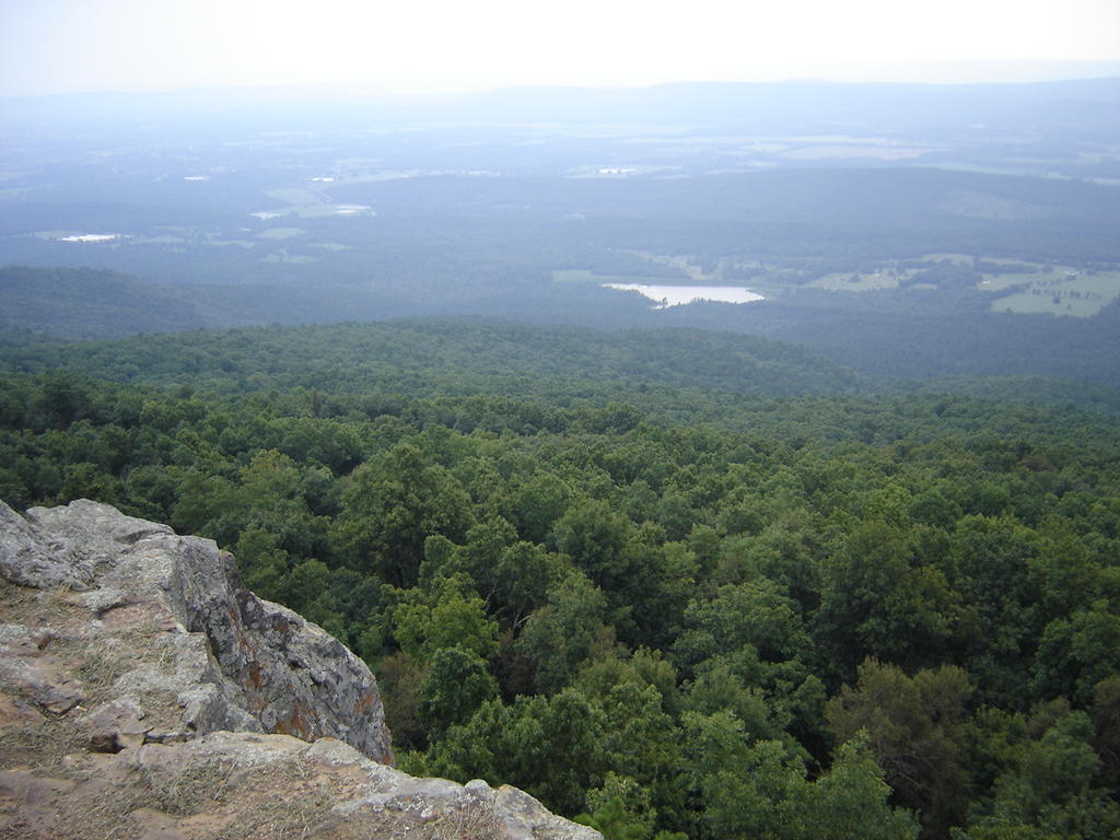
The view on the way up. This is a great road for motorcycling, although we were wishing the curvey part lasted longer!
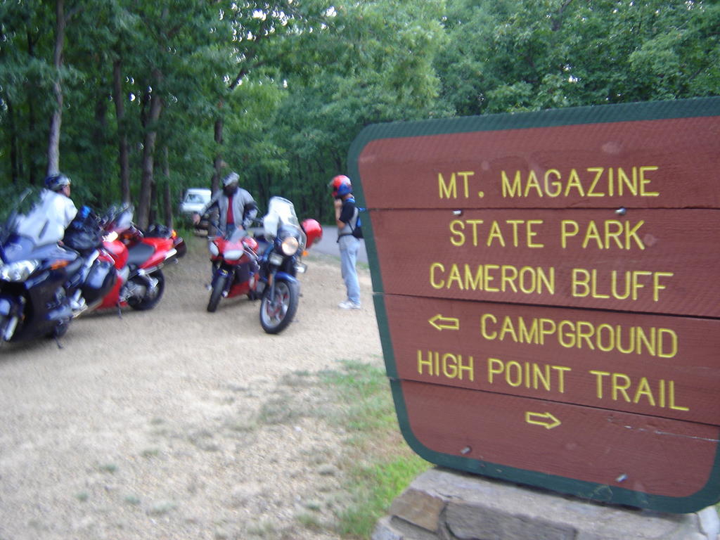
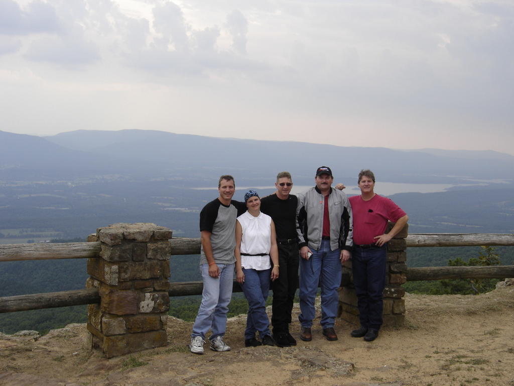
The gang, from left to right: Johnny, Dee, me, Tucker, and Craig.
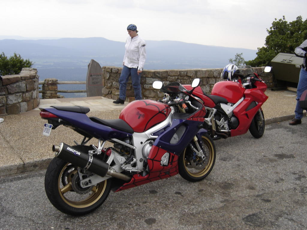
Johnny's Spiderman bike and Dee's VFR.
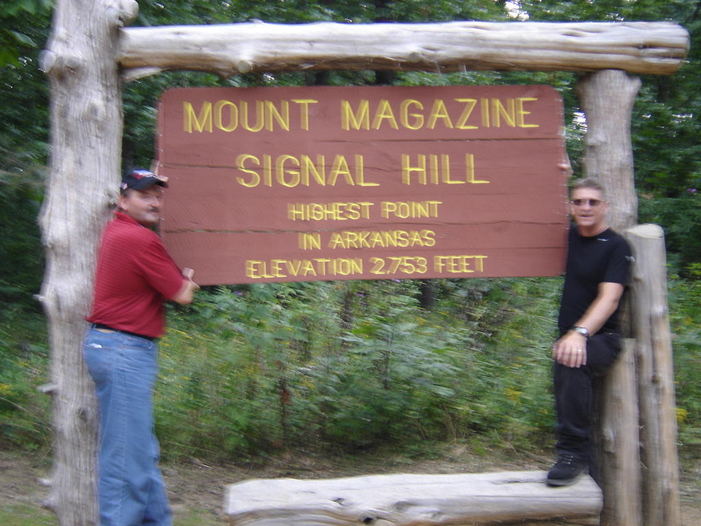
Tucker and I at the top.
Subscribe to:
Posts (Atom)