Sunday, August 21, 2005

Lone Star Trail (Double Lake and the ghost)


Today I decided to knock out a motorcycle ride and hike in one morning. A good place to start a hike is at the Double Lake Recreation Area just outside of Cold Springs, TX. Just head out I-45 North, and once you pass Conroe start looking for the New Waverly Exit (Hwy 1375 East). In a few blocks you'll come to a junction and pick up 150 East towards Cold Springs. Follow the signs from there. The exit is closer to Houston than the more popular (and more crowded) Huntsville State Park; however, once you exit, it's still another 30 miles. The road is a nice rolling twisty one with little traffic.

So, if you're sitting around in the Houston, Texas area, and looking for a place to hike, here's one to consider: The Lone Star Trail! Located just an hour or so north of Houston, this is Texas' longest trail, at 130 miles. It goes from Richards, TX to Cleveland, TX. There are plenty of spots to access this trail, so you can hike as little or as much as you want. The trailhead mentions that you need to allow 30 minutes for every mile, (or 2MPH the average walk). Today I planned on going a little faster.

The inspiration for today's walk was a book by John Annerino, "Running Wild".
It's a book about coming back from a near amputation, trail running, with lots of historical, spiritual, Indian references. If you like outdoor adventure reading, it's a great read! Here's a link to the book:

http://www.amazon.com/exec/obidos/tg/detail/-/1560251751/qid=1124711966/sr=2-3/ref=pd_bbs_b_2_3/002-7683515-7729669?v=glance&s=books


This is the swimming hole at Double Lake! If you do an out-and-back hike, bring your trunks and jump in to cool off when you're done. There are restrooms to change in. They also have a bike trail and campsites here. The entry for day-use is $5 per vehicle.

If you want more info on this trail, here's the official Trail Club Site. http://www.lshtclub.com/


I've been training for hikes for several months now, but for walking, not running. I figured I could run a few miles. After changing into my hiking boots and shorts, and noticing all the exposed roots, I decided to hike out till I found a good turn-around point, then attempt to jog all the way back.


The trail follows along beside "Big Creek", which is not much more than a trickle, as it begins just below the earth dam that creates Double Lake. I used to wade-fish Big Creek many years earlier, down around Shephard, TX. with my son. He caught his first "big mouth bass" there, with a rubber worm he rigged himself when he was about 4! It was a two pounder! I digress.


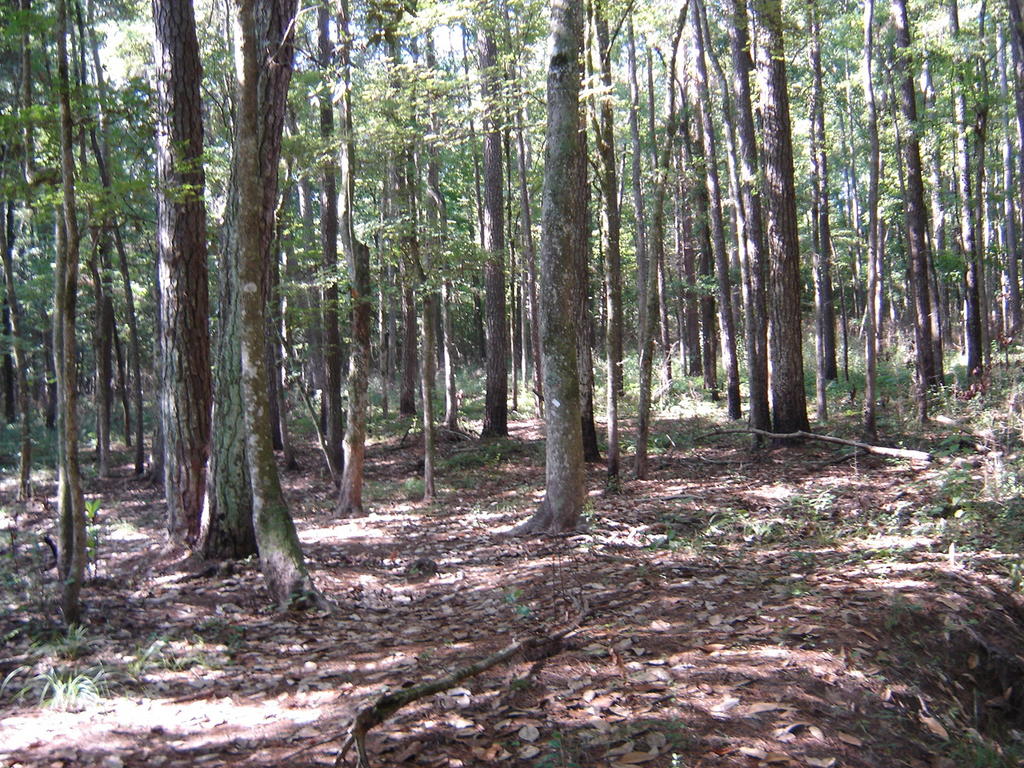
The trail is well covered and shaded in this area. Don't expect to see much sky. It's mostly flat, with only about a dozen or so bridges crossing gullies which go on to feed Big Creek. You don't really get much of a peek at Big Creek for about three miles.


This is a sign marking a campsite, about half a mile down the trail.


This is one of the larger footbridges. There are three large bridges which cross over gullies that are 8-10 feet deep. You wouldn't want to drink this water without purification.....


Here's a look at Big Creek, which is actually pretty clear. It gets it's brownish tint from tannin that leeches into it from all the pine needles it's filtered through. It's the typical East Texas stream.


So After 4 miles of walking east on the trail, you come to this marker. I decided to have lunch here, and then attempt to run back. It took an hour and a half to get here (3 MPH). My goal was to get back in an hour flat.

I have a lot more respect for trail runners now. I thought that it would be easier than street running, as the ground is softer. What happens is your legs are constantly adjusting for the different angles of terrain, and you work out muscles all around the knee that usually don't do much work. After a mile-and-a-half, I had to slow down to a fast walk. I should have brought more water.


After I regained my composure, I tried jogging uphill with small steps, then opening up my stride on downhills. I still ran out of breath after a half mile, and walked the next mile briskly. I didn't think I'd make it in an hour.... then a strange thing happened. I noticed another hiker on a bridge coming up. He was wearing a white cap and a white shirt, leaning on his hiking stick, only 20 yards ahead. I figured since I was jogging, I would have to continue to jog past him until out of sight, as not to appear like a lightweight.

Just as I should have been in front of him, I looked around, and - nothing. There was no hiker. No bridge. No kidding! I either just (a) saw a ghost, or (b) hallucinated. I decided to jog a little more.

I knew I was getting close, but it was only two minutes until my hour was up. I was sure I'd be about ten minutes late. Then, suddenly, with about ten seconds to spare, there was the lake in front of me. I'd made it!

If you ever decide to do this walk, watch out for snakes and ghosts. Email me if you happen to see the guy with the white cap.

Thursday, August 11, 2005

Mt. Elbert, Colorado

If you're planning on doing this trip, it will be a lot more fun if you train first! You could quickly tell with a glance at the faces going up who had trained and who hadn't. The trail is basically uphill 99% of the time. At times it's pretty steep, although no scrambling or bouldering is required.


Here's my pal Tucker pointing to the peak from Leadville, a few miles from the base town of Twin Lakes. You may want to rent a 4WD for the jeep road which leads to the trail head. We had a Dodge Durango 2WD which wasn't quite up to the task. This added another 3 miles or so to the round trip as we had to walk up the jeep road to the trailhead.


The jeep trail had a couple of deep ruts coming around this bend, and after seeing a 4WD almost flip, we decided to park and walk from here.


You'll have to drive through this creek, which is still about a mile out from the trailhead along the jeep trail. Another trip report described a Geo Metro which made it through the jeep road - that would have been fun to watch.


If you're walking, you can get around the creek by crossing these logs. They're wet from the spray, but at least there's a log to hold onto!


We are greeted by some Aspen shortly up the trail. Several nice campsites are set-up along the road before you get to the trailhead.


Finally, after a mile and a half of Jeep road, we arrive at the official starting point of the south Elbert Trail.

We began our hike late, about 8:30AM., as we planned on camping about a mile above the treeline the first day. We would then just relax, acclimate some more, sleep, and do an early summit. Unfortunately it played out differently. Since we hadn't really used loaded packs in a while, we were carrying too much, and couldn't make the original campsite. We ended up dropping our gear at the first big clearing, a few hundred yards short of the treeline. That was too soon (about 11:30) to set up camp, so we decided to attempt to summit, now carrying a much lighter load.


The rounded clearing at the lower right of the photo is where we dropped our gear to set up later for camp. We were just short of the halfway point here.


There were LOTS of other climbers today - perhaps 85 people and about ten dogs. These two dogs had brought along two really cute college- age girls to keep them company. We met them early on. Later, I got a picture of the girls as they were headed back down from the peak. I was surprised to see lots of ladies of all ages on the hike. A five-year-old girl peaked with her dad who was helping her back down. Lots of couples, I'd say a full third of the hikers were gals. There was also a scout troop there, perhaps 30 or so counting the Dads.


Once we got past the third large clearing we finally go out of the treeline. Now you can really see the last few lingering patches of snow scattered around. There is a really steep section after the clearings, a short respite, then an even steeper section.


Tucker took this shot of me at our first little break before we dropped most of our stuff. Some folks were surprised that we were able to cram our air mattresses, tent, food, ground cloths, and enough water for an overnight in our small daypacks! By the way, there are places to get water if you have a good filter. Had I known that, we wouldn't have lugged 6-7 pounds of water each the whole way up.

I also wanted to mention how friendly the people from Colorado were. Almost everyone we met was from there, and they were very nice and talkative. There were some nice folks from Oklahoma too. And the ladies were so "outdoorsy" and healthy, it was refreshing to meet such nice folks....


Just beyond the pass you see at right-center, the wind picks up for a while. It didn't last long, as you start to get some shelter from the peaks as you do the next steep section. After this pass is a tough section, and it starts getting more rocky.


These two scouts in front of me were playing "leapfrog" with me as we passed each other several times over almost a three mile stretch. It inspired this oldtimer (almost 50) to be able to keep up with a couple of twelve year olds....


I took a little half-mile side trip over to examine this alpine pond a little closer. This is close to where we had wanted to camp originally. Would have been a good spot to refill the canteens.


A closeup of the pond..... clear water is rushing in from the melting snow. Crystal clear, but still needs to be filtered I suppose.


Getting closer to the clouds....


This fat little marmot was expecting some food for this pose. Sorry little buddy, I'm too tired to dig in my pack right now. At this point, about the last 3/4 mile, I get into a rhythm of ten baby steps, stop, count to ten, ten baby steps, stop count to ten. Not much air to breathe, I always start to slow down after passing the 13,000 foot mark.


A photo near the snow..... I got much closer to this stuff on the way down, somewhat by accident.....


The girls that the dogs in the earlier photo brought along. They're headed back down already; notice they didn't even break a sweat.


Not much further now!


Hey, finally made it. That was pretty tough.

Now......how can I screw this up?


A closer view of the thin icy crust on top....


The saddle you see near center, is about half a mile away. Somehow I came down the wrong way, since I'm supposed to be on that saddle. Either I climb back up and backtrack, or cross the steep mountainside where there's no trail through loose scree...


Going up is not an option, so I decide to cross over. The first shot here is looking back across the scree strewn slope when I'm half way.


And here I am looking across at the remaining scree field yet to be crossed.


The drop off into "Emerald Lake" is where you fall if you slip in the scree field...


Here's what the sunset looked like from our campsite on the mountainside that nite. We got a little three-hour rain, when I discovered my "bivy sack" wasn't very waterproof. Also had my first little episode of altitude sickness, even though I was fine earlier at 3,000 feet higher altitude.

Overall, a wonderful hike, my first "fourteener". I was really pumped after this one, and even now, several days later, I'm inspired to plan the next state high point!

Wednesday, August 10, 2005

Pre-Mount Elbert

So, after a few months of getting ready, we're off to Denver, then Twin Lakes, Colorado to climb Mt. Elbert. Second highest in the lower 48 states, and our first 14'er! We arrive on Friday night. I booked us a room at this little Inn at the bottom of the mountain.


This used to be an old Wells Fargo stagecoach stop! It is very cool. From now on I plan to never spend another nite at a hotel chain before a climb. Afterwards, you just want to pass out somewhere, but the nights before are sacred. Better to sleep on a picnic table than a hotel chain!

The owners prepared a great dinner to fuel us the next morning. They are very knowledgeable of the local trails and climbs.


A link to the inn:


This is a great place, I highly recommend it for acclimating to the altitude before setting out for your climb!

Thursday, August 04, 2005

Highpointers

Highpointers are people who have committed to climbing the highest points in a given area, such as each U.S. state, which is one of the more common. Here are a few highpointer links of interest if you'd like to know more:


http://highpointers.org/
the official highpointers club website

http://www.peakware.com/encyclopedia/ranges/fiftystates2.htm A listing of state highpoints from the highest to the lowest.

http://www.surgent.net/highpoints/ A point and click map of the U.S. with highpoints and journals.